County Planner
For Athens County Planning questions contact the County Planner at 740-447-5890.
The County Planner supervises and reviews applications pertaining to subdivision and lot splits, floodplain development, and other land use projects in the county. The planner also implements goals and policies outlined in the adopted comprehensive land use plan. Other work includes oversight of the natural hazard mitigation plan and involvement in grant applications and administration.
The County Planner supervises and reviews applications pertaining to subdivision and lot splits, floodplain development, and other land use projects in the county. The planner also implements goals and policies outlined in the adopted comprehensive land use plan. Other work includes oversight of the natural hazard mitigation plan and involvement in grant applications and administration.
Regulations
|
Although Athens County does not have adopted Zoning Regulations, the County does have Subdivision and Floodplain regulations which apply to property splits and any development that occurs in the flood hazard area.
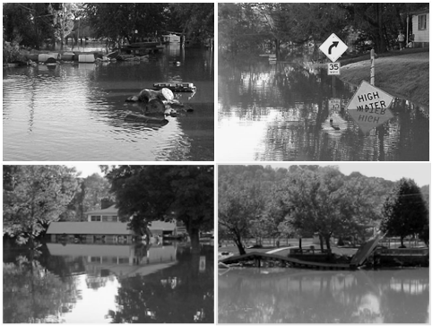
Flooding Regulations Please be aware that any development in the floodplain requires a permit. Development includes residential and non-residential building construction, installation of manufactured homes, substantial rehabilitation or alteration of structures, accessory building construction, materials storage, filling and grading, mining and dredging, and watercourse alteration. Anyone considering development in floodplain areas should consult with the planning office prior to starting a project. The planning office can help determine whether someone’s property is affected by the flood damage prevention regulations.
| ||
Subdivision Regulations
In order to subdivide property, a permit is required from the County Planner’s office. Please contact the Planner’s office to determine if your subdivision is minor or major.
A subdivision is the division of land into parcels, any one of which is less than five acres in size. A subdivision also exists if all the parcels are greater than five acres in size, but need a new street or easement of access. A transfer of land between adjoining property owners, which is not a building site, is not a subdivision. A building site is defined as a parcel under separate deed or description containing less than five acres and having road frontage.
| Subdivision Regulations |
Plans in Athens County
Athens County has adopted two significant Planning Documents, The Multi-Jurisdictional Natural Hazard Mitigation Plan and the Comprehensive Land Use Plan. These Plans are essential for protecting residents and property as well as guiding development in responsible manner.
The Natural Hazard Mitigation Plan was initially adopted in 2004 and the County is currently in the process of updating this Plan.
The Comprehensive Plan was adopted by the County Commissioners in 2010 and the County is currently in the process of working to implement some of the goals and policies in the Plan.
Projects
|
The Athens County Planning is addressing future development in the County. Some current projects include:
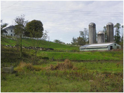
FARMLAND PRESERVATION: A farmland preservation committee was established to review existing agricultural land uses and to promote an agricultural economy. COUNTY PARKS & RECREATION: The county has parks and recreational areas, including the Hock-Hocking Adena Bikeway and Ferndale Park, that have active volunteer organizations that monitor and plan for the future. GIS – Geographic Information Systems: This detailed mapping program will help identify floodplain properties, industrial and commercial development sites, and act as a valuable land us planning tool for the county. Working in conjunction with the Athens County Engineer's office, the City-County Health Department, the County Auditor, the City of Athens, and Ohio University a unified GIS mapping effort will help plan for the future of Athens County. For additional information on GIS in Athens County, please visit the County's GIS webpage. |